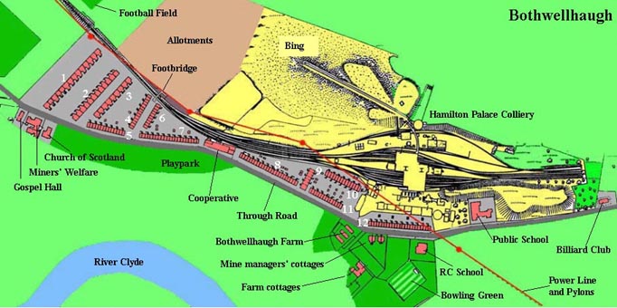
Map of the colliery and the village.
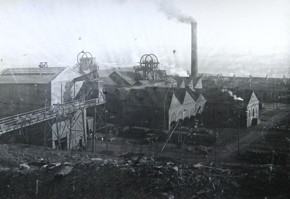
The pithead area
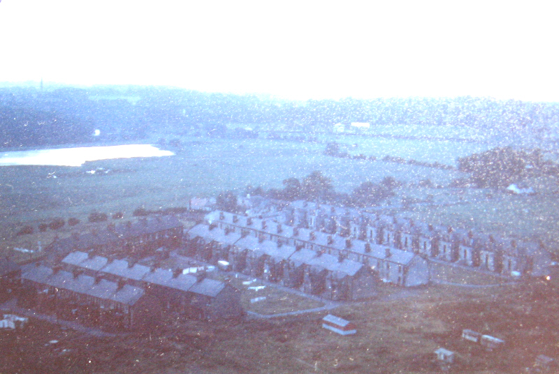
View of western end of the village, taken from the main mine dump.
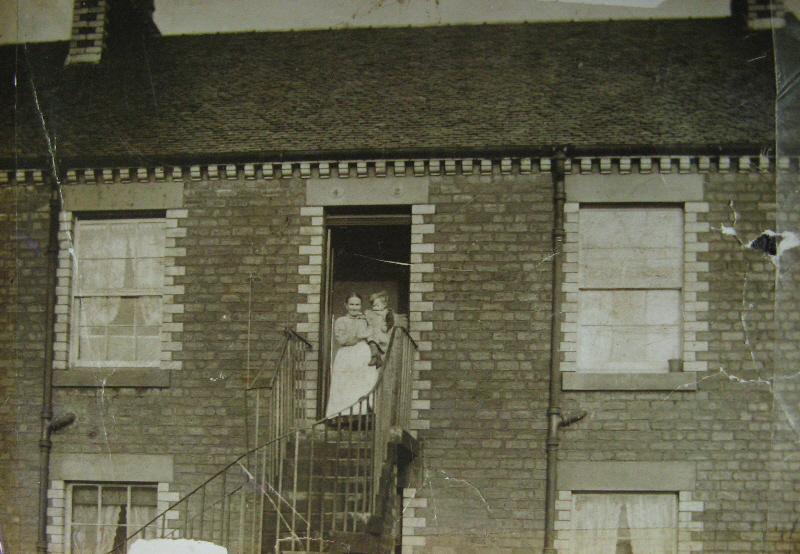
1 Calder Place
Most of the photographs in this section come from the superb collection of Bothwellhaugh photographs put together by Matt Mitchell, Senior Ranger at Strathclyde Country Park. They are used by courtesy of North Lanarkshire Council.
In the early 1880s the only settlement at Bothwellhaugh was Bothwellhaugh Farm. The farm was occupied by James Baird, his wife, and their domestic servant. Today Bothwellhaugh forms part of Strathclyde Country Park. But for eight decades from 1884 there was a coal mine and a village, both of which disappeared in the 1960s.
For a map of the area today go to the website of the Gazetteer for Scotland.
Bothwellhaugh lay close to the north bank of the river Clyde, about ten miles south east of Glasgow. In the nineteenth century it was owned by the Duke of Hamilton. After the discovery in 1850 of extensive coal seams on the Hamilton estates several collieries were developed. The lease of mineral rights at Bothwellhaugh was granted to the Bent Colliery Company, who sunk two pits on the site, and named it the Hamilton Palace Colliery.
The Hamilton Palace colliery proved to be highly productive. In 1913 an average of 2000 tons a day was being excavated. Over 1120 staff were employed underground, and a further 280 at the pit head and in the offices.
A lot more information about the Hamilton Palace Colliery, and the community at Bothwellhaugh,
can be found in a booklet, Bothwellhaugh: A Lanarkshire Mining Community, 1884-
Housing was provided by the Bent Colliery Company soon after the mine had opened.
One group of rows of terraced houses was built close to the pithead at the end of
the 1880s and into the 1890s. Further terraces were added at the western end of the
village in 1904-
In 1910 a report on Housing Conditions by the County Medical Officer for Lanarkshire gave figures for Bothwellhaugh on number and sizes of dwellings, and rents to be paid. 240 employees lived in rented accommodation away from Bothwellhaugh, but in the village itself 965 staff members and their families occupied a total of 458 houses. These were classified according to size:
· 79 one room dwellings, where the annual rent was £5 4s or £4 17s 6d depending on whether the water supply was inside or outside the house.
· 349 houses with two rooms, the rent following a scale according to whether a dry toilet, scullery, or water closet were included.
· 27 houses with three rooms, a few of which included a bath.
· 3 houses with four rooms. The rent for these houses, described as having all modern conveniences, was £15 12s. I assume they were occupied by more senior staff.
The Medical Officer’s report added that the houses had ventilated floors and walls with damp proof courses. Daily collection of refuse and emptying of ash pits were the responsibility of the mine owners.
Apart from the few people who had a bath the options for washing were (a) to use the sink, (b) use a tub placed in front of the kitchen fire, or (c) take your turn at the nearest communal washroom. Staff emerging from an eight hour shift at the coal face did not have the benefit of pit head baths, but would have to go home first before getting washed.