Abandoned Communities ..... Buckinghamshire
We will now consider what is known about the layout of both villages before they were enclosed. Neither Littlecote nor Lillingstone Dayrell have been excavated, but at Littlecote in particular much has been learnt from examination of the surviving earthworks. At Lillingstone Dayrell some general information, especially about the position of the streets and houses, has been obtained from systematic field walking.
At Littlecote a broad and deep hollow way that runs from north east to south west is assumed to have been the main road through the village. On the map on the first page of this section it is shown diverging from the modern road about a hundred metres south of Littlecote Farm.
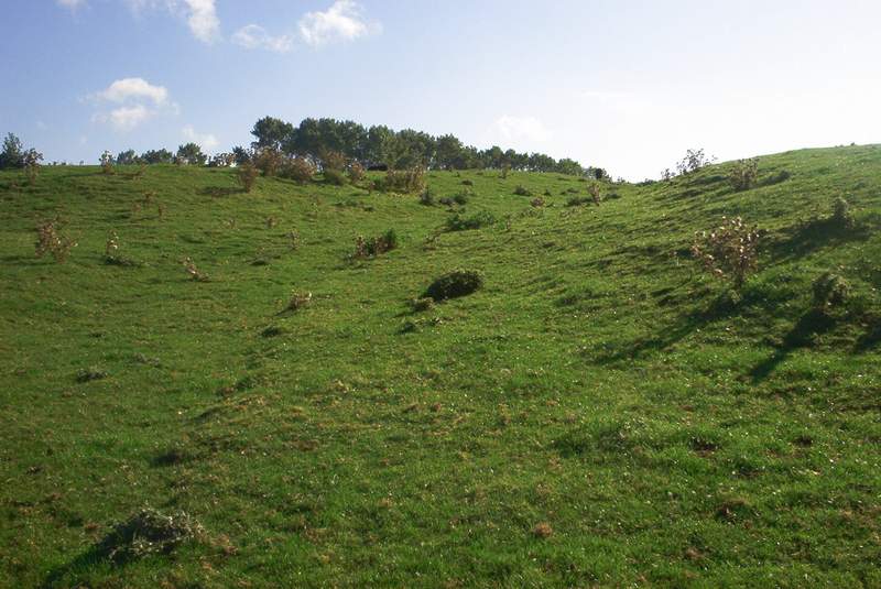
On the east side of the hollow way there is a series of crofts that climb the slope of a small ridge. They extend about 200 metres from the street, and are marked by ditches, banks, and trackways. They contain raised platforms that would have held houses and other buildings.
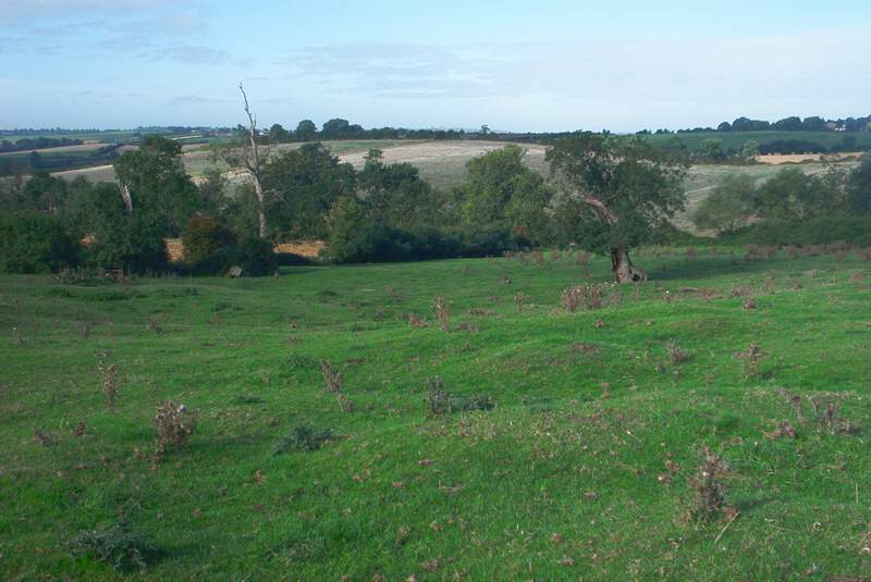
On the west side of the main street lay the communal fields. A document of 1248 reveals that at that time a three field system was in use at Littlecote. Crops would have been rotated and one of the three fields left fallow for grazing and fertilisation of the soil. The three open fields would have been divided into furlongs which were cultivated in narrow strips allocated to individual tenants and serfs. Medieval fields often leave a characteristic ridge and furrow pattern. The ridges, each about ten metres wide, resulted from the type of ploughing that was used, and the dips between them assisted the drainage of the land. Such ridges are clearly visible at Littlecote. At the western boundary of the field containing the ridge and furrow pattern you can also see the headland created by the turning of the plough.
Bing Maps provides an aerial view of Littlecote, with the ridge and furrow pattern clearly visible.
The manor house is thought to have existed where buildings, until recently part of Littlecote farm, now stand. In the seventeenth century it was replaced by a new mansion, which in turn was replaced by a farmhouse in 1804. The farmhouse still exists, but is now used as a private residence.
Littlecote did not have a church as it was part of the parish of Stewkley. There was, however, a chapel, founded in 1266 and dedicated to St Giles. It was intended to be a chantry, that is a place where masses would be sung for the souls of the lord of the manor and his family, but it may also have been used as a place of worship by other residents of the village. Next to the chapel a house and outbuildings were provided for the chaplain, who in addition was granted a share of the arable land of the village. The site of the chapel is thought to have been where a rectangular earthwork now exists a short distance south of the farmhouse. Perhaps one day excavation will confirm this.
South east of the manor house lay a series of fishponds. Fish taken from them would have provided an important part of the diet of the lord of the manor and his family, and also, in the words of the English Heritage report mentioned earlier, “enabled compliance with religious dietary customs.” Two of the ponds, both lying within a small copse, still contain water. Their dams were reinforced with brickwork in the late eighteenth century. The hollowed remains of two or three further ponds can be seen south of the copse.
At Littlecote a broad and deep hollow way that runs from north east to south west is assumed to have been the main road through the village. On the map on the first page of this section it is shown diverging from the modern road about a hundred metres south of Littlecote Farm.
On the east side of the hollow way there is a series of crofts that climb the slope of a small ridge. They extend about 200 metres from the street, and are marked by ditches, banks, and trackways. They contain raised platforms that would have held houses and other buildings.
On the west side of the main street lay the communal fields. A document of 1248 reveals that at that time a three field system was in use at Littlecote. Crops would have been rotated and one of the three fields left fallow for grazing and fertilisation of the soil. The three open fields would have been divided into furlongs which were cultivated in narrow strips allocated to individual tenants and serfs. Medieval fields often leave a characteristic ridge and furrow pattern. The ridges, each about ten metres wide, resulted from the type of ploughing that was used, and the dips between them assisted the drainage of the land. Such ridges are clearly visible at Littlecote. At the western boundary of the field containing the ridge and furrow pattern you can also see the headland created by the turning of the plough.
Bing Maps provides an aerial view of Littlecote, with the ridge and furrow pattern clearly visible.
The manor house is thought to have existed where buildings, until recently part of Littlecote farm, now stand. In the seventeenth century it was replaced by a new mansion, which in turn was replaced by a farmhouse in 1804. The farmhouse still exists, but is now used as a private residence.
Littlecote did not have a church as it was part of the parish of Stewkley. There was, however, a chapel, founded in 1266 and dedicated to St Giles. It was intended to be a chantry, that is a place where masses would be sung for the souls of the lord of the manor and his family, but it may also have been used as a place of worship by other residents of the village. Next to the chapel a house and outbuildings were provided for the chaplain, who in addition was granted a share of the arable land of the village. The site of the chapel is thought to have been where a rectangular earthwork now exists a short distance south of the farmhouse. Perhaps one day excavation will confirm this.
South east of the manor house lay a series of fishponds. Fish taken from them would have provided an important part of the diet of the lord of the manor and his family, and also, in the words of the English Heritage report mentioned earlier, “enabled compliance with religious dietary customs.” Two of the ponds, both lying within a small copse, still contain water. Their dams were reinforced with brickwork in the late eighteenth century. The hollowed remains of two or three further ponds can be seen south of the copse.
Three
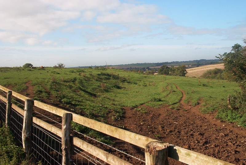
The hollow way where the main street once lay (seen from the north)
The hollow way (from the south)
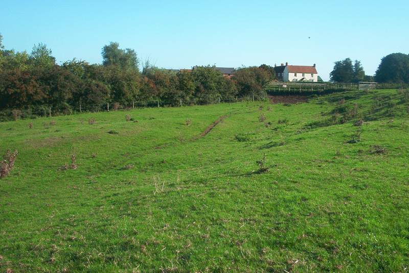
A track between two crofts
Lower section of the crofts
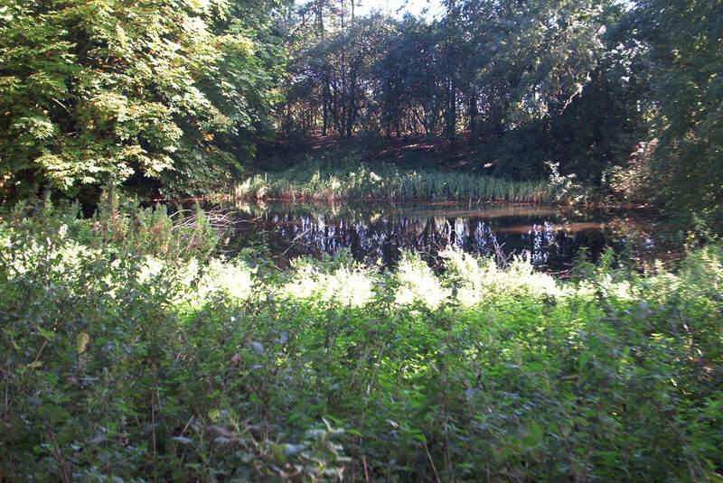
One of the fishponds
Ridge and furrow pattern in the medieval field