Another issue raised by the experience of the people of Kenfig is the degree to which
those who are forced to leave their community succeed in integrating with others
in the surrounding area. People from Kenfig were re-
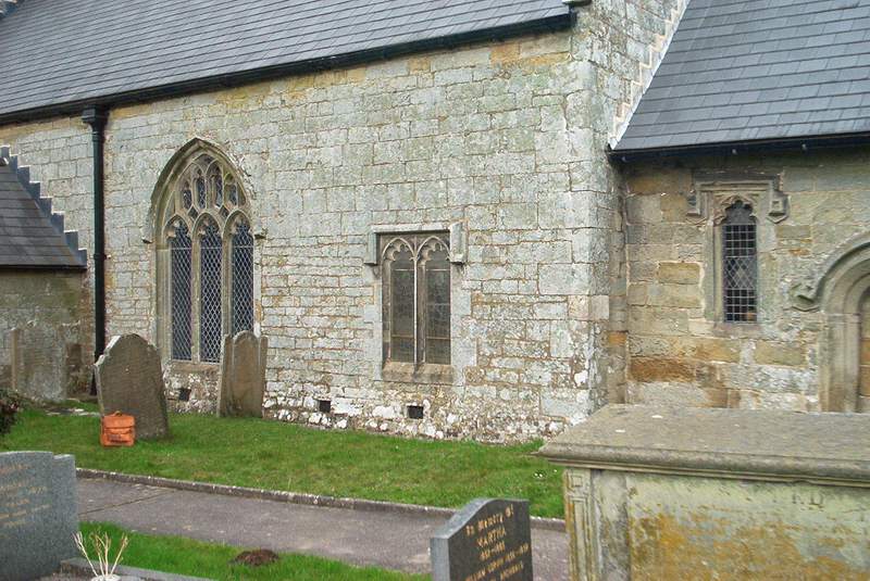
One topic that gave rise to disagreement was the designation of the new parish church in Pyle, built in 1471. The church was dedicated to St James, as the church that had existed in Kenfig had been. Indeed stone was transferred from the old church to the new one. If you look at the south wall of the church in Pyle you can see that smaller stones were used at the base and larger stones at a higher level, clearly representing the order in which they would have arrived. Some of the residents of Pyle proposed that the parish should be called Pyle and Kenfig, but others, presumably those from Kenfig, wanted it to be simply Kenfig. In 1485 the Bishop of Llandaff decided that it would indeed be called the parish of Pyle and Kenfig. Even then one side persisted in calling the parish “the parish of Pyle”, the other side the parish of Kenfig.
You may be wondering what there is to see if you visit the site of Kenfig today.
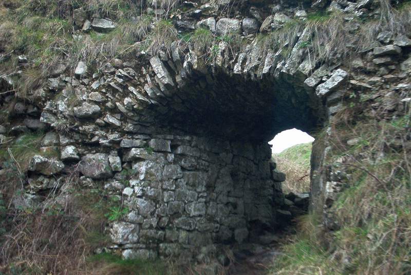
You will come across a small hillock of sand surmounted by some unimpressive masonry
that once formed part of the upper section of the castle. Apart from that there is
nothing to see but dunes, and, depending upon the season of the year, a diversity
of birdlife and flowering plants.
The Ordnance Survey reference number of Kenfig
is SS801826.
Walk just under half a mile to the south and you will reach a large freshwater
lake known as Kenfig Pool. The whole area was declared a site of Special Scientific
Interest in 1954 and has been a National Nature Reserve since 1989. The Information
Centre is well worth a visit.
The introduction to Thomas Gray's book was written by
Walter de Gray Birch in prose that can only be described as purple. He referred to
"a wild and lonely solitude of sand". Even in 1909 that was not strictly true as
the mainline railway from Swansea to London ran less than a quarter of a mile north
east of the site of Kenfig. Today you will also be aware of the M4 motorway, and
if you look north west across an area of waste land that has not found another use
since it was a railway marshalling yard you will see the steelworks and oil refineries
of Port Talbot. If, however, you keep your gaze to the south and west then de Gray
Birch's description is not far wrong.
The memory of the lost town is kept alive by
the Kenfig Society, a group of enthusiastic, friendly, and intellectually adventurous
amateur historians. They have produced an excellent series of publications.
Soon after
the formation of the society in 1989 a special group was set up to take responsibility
for archaeological investigation of the town and castle. It is likely that the most
productive method of investigation would be the use of ground penetrating radar,
but GPR is far beyond the modest financial resources available to the society. In
its absence the special group has resorted to digging, but in this respect too they
have been subjected to severe limitations as Cadw, the guardians of Welsh heritage,
have been well aware of their amateur status and have not allowed them to excavate
within the vicinity of the castle.
The main discoveries of the special group have
been ridge and furrow patterns in the ground and an isolated building, apparently
not used for residential purposes. After animated discussion of alternative theories
the group recognised the ridge and furrow patterns as evidence of medieval ploughing.
The building remains a puzzle. A summary of work to date was written by Terry Robbins
and published in 2002.
Terry Robbins, Digging Up Kenfig, Kenfig Society Monograph
No. 22, 2002.
This booklet is illustrated with maps and diagrams, with photographs
of excavated areas and artefacts, and with photographs of members of the special
group. In the latter you can see the first spade-
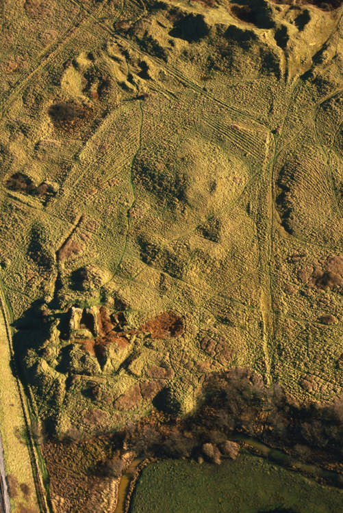
Aerial view of Kenfig castle and the surrounding area