Abandoned Communities ..... Strathnaver
The official account of the redevelopment of the Sutherland estate and its immediate outcome was published by James Loch in 1820, "An Account of the Improvement on the Estate of Sutherland". It refers to:
• Quantities of mutton and wool now being produced.
• Construction of roads, bridges, and harbours.
• Emergence of industrious and regular habits in the former inhabitants of the interior.
• Importation of coal, timber, slates, bricks, and lime.
• Opening of a brewery and three inns (and the closure of many illegal whiskey distilleries).
A later review, focussing on the experience of people who moved to coastal crofts, was provided by Rev David MacKenzie, who as we have seen had mixed views about the clearances. Written in 1834, it forms part of the New Statistical Account of Scotland.
Again I am willing to leave the last word on the changes to Donald MacLeod, who wrote: "There were roads, bridges, inns and manses to be sure, for the accommodation of the new gentlemen, tenantry and clergy, but those who spoke the Gaelic tongue were a proscribed race, and everything was done to get rid of them, by driving them into the forlorn hope of deriving subsistence from the sea while squatting on their miserable allotments where, in their wretched hovels, they lingered out an almost hopeless existence."
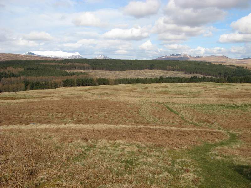
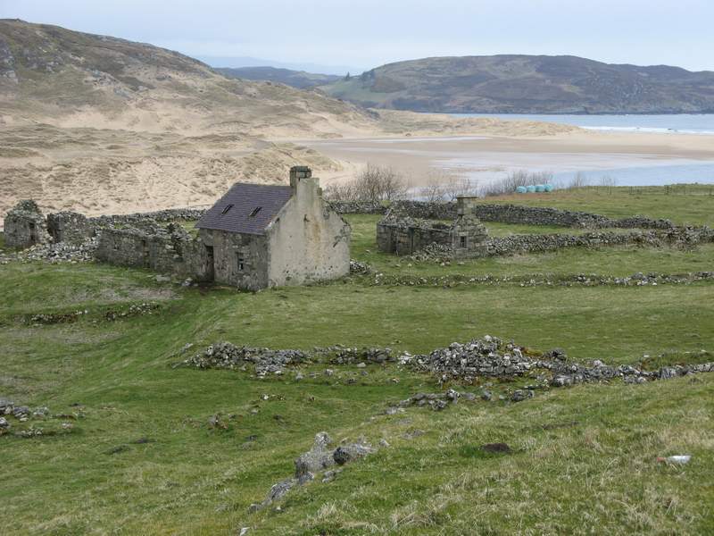
Visiting Strathnaver today, you can start either at Altnaharra or at Bettyhill on the coast. If you begin at Altnaharra you will follow the north shore of Loch Naver along the B873 (a single track road, but you hardly ever meet another vehicle), and then turn north along the west bank of the River Naver. You may choose to follow the Naver Trail, which includes 16 places of special interest, including several of the deserted villages. These include Grummore, where at the time of the clearances there were 117 people in 22 households, Rosal (79 people in 15 households), and Achanlochy (45 people in 11 households)
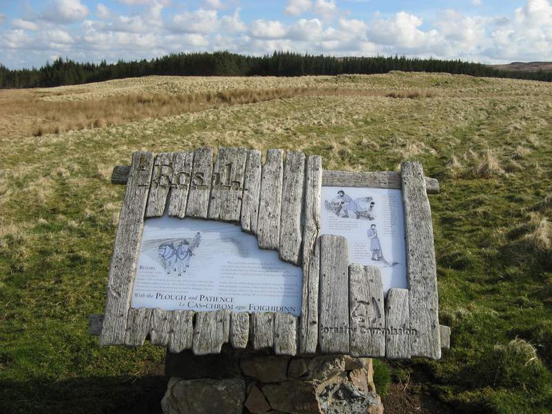
Good information boards will be found at each of the 16 places, but for additional information take with you a booklet, Strathnaver Trail, by Jim A Johnson, published by the Highland Council in 2003. This booklet can be downloaded from the website of The Highland Council. For even more information use the excellent booklet What to See in Strathnaver: A Guide to Local History and Archaeology, by Kevin O’Reilly and Ashley Crockford.
The village of Rosal, at OS NC 689416, occupied what is now a large open space within an area of modern forestry. You can see where some of the houses were, and there are traces of small ploughed fields. In places you can see the remains of the boundary dyke, and close to the dyke there is a corn kiln now almost buried by vegetation.
An archaeological investigation of Rosal was undertaken in the 1960s by Horace Fairhurst. Fairhurst’s report was published as Rosal: A Deserted Township in Strath Naver, Sutherland, Proc. Soc. Ant. Scot. 1969, 100, 135-169. The report can be found on the internet at the Archaeology Data Service.
Donald MacLeod lived at Rosal. There is a modest memorial to him on the western bank of the River Naver not far from the village.
When you reach the coast you will be able to visit the Strathnaver Museum, housed in the former parish church of Farr, and get an impression of the environment around Betthyhill where some people from Strathnaver were resettled in crofts.
• Quantities of mutton and wool now being produced.
• Construction of roads, bridges, and harbours.
• Emergence of industrious and regular habits in the former inhabitants of the interior.
• Importation of coal, timber, slates, bricks, and lime.
• Opening of a brewery and three inns (and the closure of many illegal whiskey distilleries).
A later review, focussing on the experience of people who moved to coastal crofts, was provided by Rev David MacKenzie, who as we have seen had mixed views about the clearances. Written in 1834, it forms part of the New Statistical Account of Scotland.
Again I am willing to leave the last word on the changes to Donald MacLeod, who wrote: "There were roads, bridges, inns and manses to be sure, for the accommodation of the new gentlemen, tenantry and clergy, but those who spoke the Gaelic tongue were a proscribed race, and everything was done to get rid of them, by driving them into the forlorn hope of deriving subsistence from the sea while squatting on their miserable allotments where, in their wretched hovels, they lingered out an almost hopeless existence."
Visiting Strathnaver today, you can start either at Altnaharra or at Bettyhill on the coast. If you begin at Altnaharra you will follow the north shore of Loch Naver along the B873 (a single track road, but you hardly ever meet another vehicle), and then turn north along the west bank of the River Naver. You may choose to follow the Naver Trail, which includes 16 places of special interest, including several of the deserted villages. These include Grummore, where at the time of the clearances there were 117 people in 22 households, Rosal (79 people in 15 households), and Achanlochy (45 people in 11 households)
Good information boards will be found at each of the 16 places, but for additional information take with you a booklet, Strathnaver Trail, by Jim A Johnson, published by the Highland Council in 2003. This booklet can be downloaded from the website of The Highland Council. For even more information use the excellent booklet What to See in Strathnaver: A Guide to Local History and Archaeology, by Kevin O’Reilly and Ashley Crockford.
The village of Rosal, at OS NC 689416, occupied what is now a large open space within an area of modern forestry. You can see where some of the houses were, and there are traces of small ploughed fields. In places you can see the remains of the boundary dyke, and close to the dyke there is a corn kiln now almost buried by vegetation.
An archaeological investigation of Rosal was undertaken in the 1960s by Horace Fairhurst. Fairhurst’s report was published as Rosal: A Deserted Township in Strath Naver, Sutherland, Proc. Soc. Ant. Scot. 1969, 100, 135-
Donald MacLeod lived at Rosal. There is a modest memorial to him on the western bank of the River Naver not far from the village.
When you reach the coast you will be able to visit the Strathnaver Museum, housed in the former parish church of Farr, and get an impression of the environment around Betthyhill where some people from Strathnaver were resettled in crofts.
Six
The site of the village of Rosal
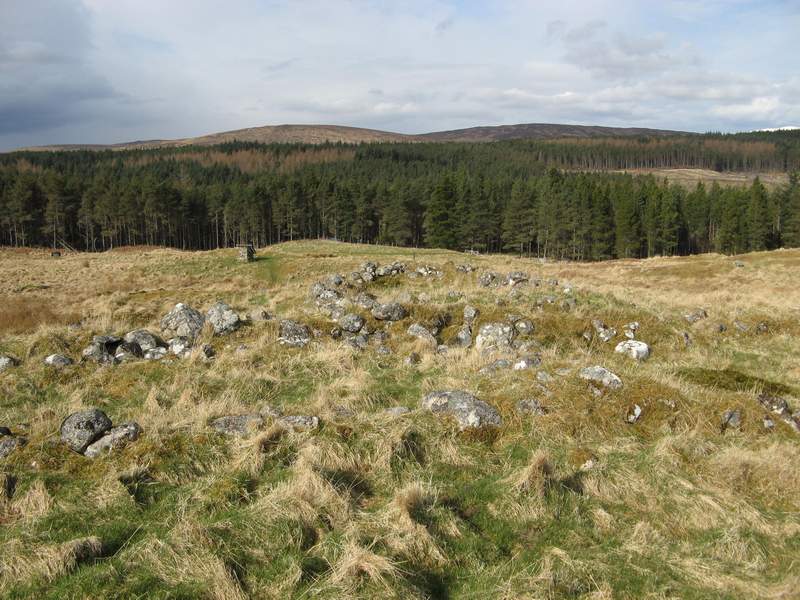
Remains of a longhouse at Rosal
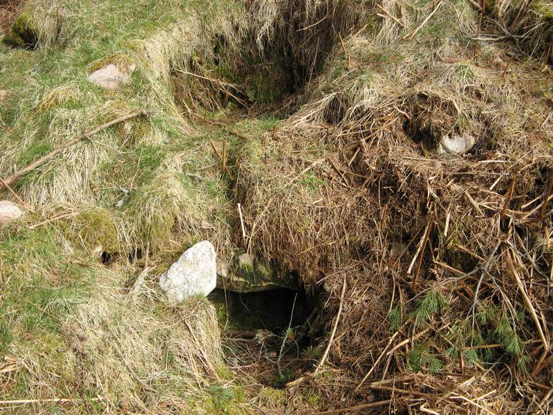
A corn kiln
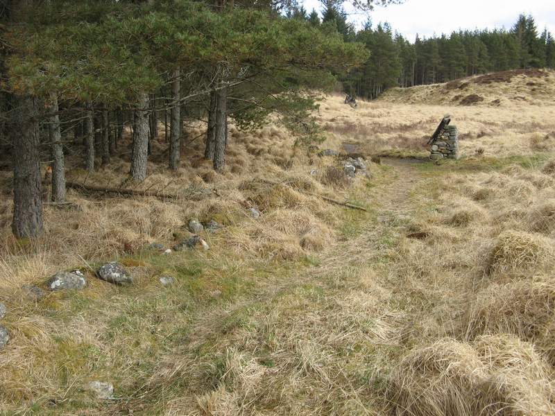
A small section of the boundary dyke
Bettyhill
A ploughed area