Abandoned Communities ..... Wharram Percy
During the Middle Ages Wharram Percy was a small and not particularly significant village. It lay in the Yorkshire Wolds about eighteen miles north east of York. It has become well known as a result of the archaeology and other research conducted there since 1948. In that year Maurice Beresford began to take an interest in the village and initiated a series of annual summer excavations that continued until 1990.
Maurice Beresford died on 15 December 2005. An obituary about him can be read on The Guardian website.
Memories of the summer excavations, and a lot of nostalgic photographs, appear in C Hayfield, Wharram Remembered, Spring Hill Publications, 1990.
There is evidence of settlement and farming on the site of Wharram Percy going back at least to the early Iron Age. It continued to be occupied during the Roman and Saxon periods. At some point in time a village was planned. We do not know whether houses already existed in small groups and the plan was used to guide further development, or whether the plan was devised at an early stage before any significant “nucleation”. It is thought likely that the planning took place in the tenth century, though there is some evidence, especially from the existence of a long “lynchet” bank running through the western plots, that it did not happen until the twelfth century.
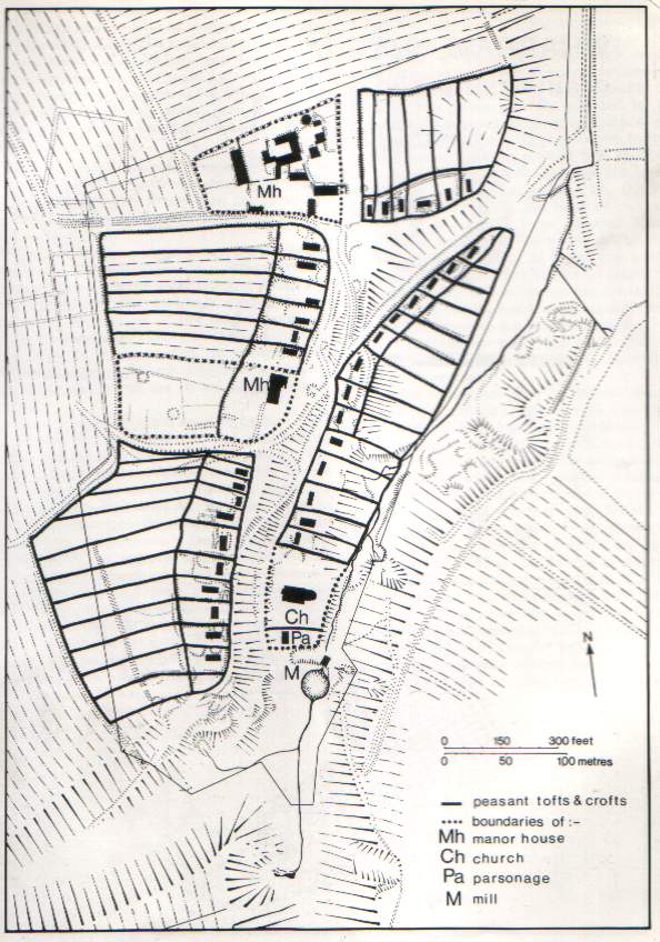
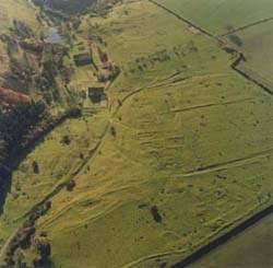
Good views of the layout of Wharram Percy have come from aerial photographs such as the one on the left (where the Church appears near the top and the northern manor house at the bottom). Examination of earthworks on the ground, excavation, and geophysical surveys have provided more detailed information. Beresford and his colleague John Hurst have put the evidence together to produce a plan of the village.
M Beresford & J Hurst, Wharram Percy: Deserted Medieval Village, B T Batsford / English Heritage, 1990.
The plan shows two roughly parallel rows of plots running from north to south. Most of the plots have a house close to their front boundary, surrounded by a toft and with a croft behind.
The toft was a small yard or garden immediately surrounding the house, the croft a larger area used by the tenant for growing crops or keeping a few animals.
At the northern end of the village lay one of the two manor houses, with another six properties to the east of it. Altogether there were about 35 properties.
The plots on the eastern side of the village lay in the valley, on land that is roughly level or gently sloping towards the south. Between these plots and the plots to the west is a moderately steep slope, and the western plots lay on the plateau at the top of the slope.
Maurice Beresford died on 15 December 2005. An obituary about him can be read on The Guardian website.
Memories of the summer excavations, and a lot of nostalgic photographs, appear in C Hayfield, Wharram Remembered, Spring Hill Publications, 1990.
There is evidence of settlement and farming on the site of Wharram Percy going back at least to the early Iron Age. It continued to be occupied during the Roman and Saxon periods. At some point in time a village was planned. We do not know whether houses already existed in small groups and the plan was used to guide further development, or whether the plan was devised at an early stage before any significant “nucleation”. It is thought likely that the planning took place in the tenth century, though there is some evidence, especially from the existence of a long “lynchet” bank running through the western plots, that it did not happen until the twelfth century.
Good views of the layout of Wharram Percy have come from aerial photographs such as the one on the left (where the Church appears near the top and the northern manor house at the bottom). Examination of earthworks on the ground, excavation, and geophysical surveys have provided more detailed information. Beresford and his colleague John Hurst have put the evidence together to produce a plan of the village.
M Beresford & J Hurst, Wharram Percy: Deserted Medieval Village, B T Batsford / English Heritage, 1990.
The plan shows two roughly parallel rows of plots running from north to south. Most of the plots have a house close to their front boundary, surrounded by a toft and with a croft behind.
The toft was a small yard or garden immediately surrounding the house, the croft a larger area used by the tenant for growing crops or keeping a few animals.
At the northern end of the village lay one of the two manor houses, with another six properties to the east of it. Altogether there were about 35 properties.
The plots on the eastern side of the village lay in the valley, on land that is roughly level or gently sloping towards the south. Between these plots and the plots to the west is a moderately steep slope, and the western plots lay on the plateau at the top of the slope.
One
An aerial view, looking south
A plan of the village, with north at the top
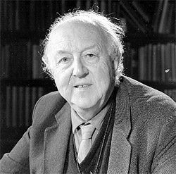
Maurice Beresford