Abandoned Communities ..... Y Graig
Y Graig is a steep hill about three miles west of Abergavenny in Monmouthshire. It faces south south west, overlooking the River Usk and Britain’s most beautiful trunk road. A settlement existed here in the eighteenth and nineteenth centuries, stretched out along the side of the hill for about a mile.
In 1998 Y Graig was declared a Scheduled Ancient Monument by Cadw, the organisation responsible for the preservation of Welsh heritage. A survey carried out in preparation for the scheduling identified the ruined remains of about 25 dwellings, various other buildings, yards, orchards, and trackways.
A more thorough survey was carried out on behalf of the Clwyd Powys Archaeological Trust by Nigel Jones early in 2003. Before visiting Y Graig Nigel Jones and his colleagues produced a digital map of the area portraying all relevant features shown on early Ordnance Survey 25” maps, with some additional details taken from a Tithe survey published in 1842. During the course of fieldwork previously known features were confirmed and several new ones identified.
The report on Y Graig is Clwyd Powys Archaeological Trust Report number 515, and with it you will receive copies of the OS maps, the Tithe map, and the digital maps produced by Nigel Jones.
Confirming known features and discovering new ones was often difficult. The hillside is now owned and managed by Forestry Commission Wales. It is covered by broadleaf woodland and areas of planted conifers. Much of it is very steep. At least one structure was spotted on one visit and then never found again. It is likely that unknown features still remain to be discovered.
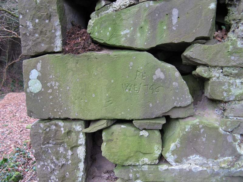
The houses at Y Graig fall into three groups, with a few scattered houses at the western end, several in the central area, and others, including the most well preserved, at the eastern end. One of the houses at the eastern end (PRN 5819 at OS 260161) contained a bakery and possibly a dairy. On one house (PRN 5839 at OS 257161) the date 1746 has been inscribed on a large stone at the north west corner of the building, presumably an indication of the date of construction.
In 1998 Y Graig was declared a Scheduled Ancient Monument by Cadw, the organisation responsible for the preservation of Welsh heritage. A survey carried out in preparation for the scheduling identified the ruined remains of about 25 dwellings, various other buildings, yards, orchards, and trackways.
A more thorough survey was carried out on behalf of the Clwyd Powys Archaeological Trust by Nigel Jones early in 2003. Before visiting Y Graig Nigel Jones and his colleagues produced a digital map of the area portraying all relevant features shown on early Ordnance Survey 25” maps, with some additional details taken from a Tithe survey published in 1842. During the course of fieldwork previously known features were confirmed and several new ones identified.
The report on Y Graig is Clwyd Powys Archaeological Trust Report number 515, and with it you will receive copies of the OS maps, the Tithe map, and the digital maps produced by Nigel Jones.
Confirming known features and discovering new ones was often difficult. The hillside is now owned and managed by Forestry Commission Wales. It is covered by broadleaf woodland and areas of planted conifers. Much of it is very steep. At least one structure was spotted on one visit and then never found again. It is likely that unknown features still remain to be discovered.
The houses at Y Graig fall into three groups, with a few scattered houses at the western end, several in the central area, and others, including the most well preserved, at the eastern end. One of the houses at the eastern end (PRN 5819 at OS 260161) contained a bakery and possibly a dairy. On one house (PRN 5839 at OS 257161) the date 1746 has been inscribed on a large stone at the north west corner of the building, presumably an indication of the date of construction.
One
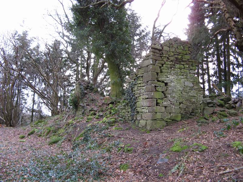
The remains of a house (PRN 5839)
Date inscribed on the corner of PRN 5839
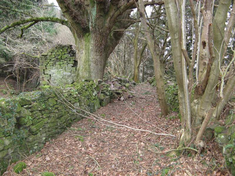
Walled trackway running past PRN 5839, possibly a drovers’ road
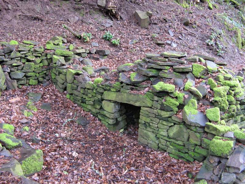
A pig cote, PRN 5841, not far from house PRN 5839
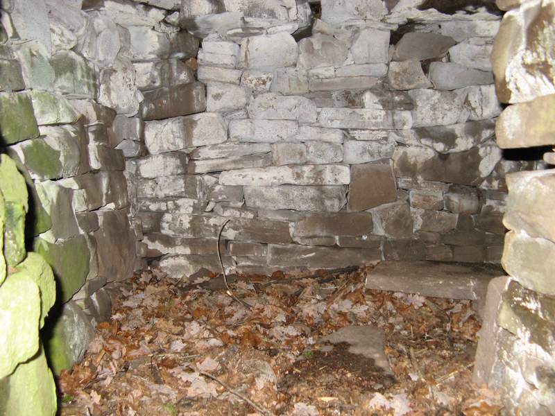
Inside the pig cote