Abandoned Communities ..... Shifting Sands
In the seventeenth century the River Findhorn did not run straight out into the Moray Firth. As it approached the sea it was diverted sharply to the west by a sand bar that ran for about two miles parallel to the shore of the Culbin estate. The bar is shown, albeit with no clear outline, on a map produced by Timothy Pont in 1590 (shown on the previous page), and it appears again on a map produced by Capt. Grenville Collins for the Great Britain Coasting Pilot published in 1693.
You can see from Pont’s map that the original village of Findhorn lay on the bar itself. In the seventeenth century it was an important sea port for trade and fishing. A lot of trade passed through Findhorn on its way to Forres and Elgin. One ship leaving Findhorn in the 1680s was recorded as carrying beef, tongues, hides, barley, and malt. In 1648 a ship discharged a cargo that comprised salt, iron, tobacco, lint, vinegar, alum, pepper, raisins, sugar, seed, and ginger
By the end of the seventeenth century, however, it had dawned on its inhabitants that physical changes in the estuary and the shape of the sand bar would soon threaten the village. The river channel had become shallower as sand accumulated within it, while at the point where the village lay the sand bar was suffering erosion by the river on its southern side.
The people of Findhorn came to an agreement with Sir James Calder, laird of the village of Muirton, that they would move to that village, about a mile to the south east. The extended village would be given the name of Findhorn. It is likely that a lot of stone and other building materials were moved from the old village and used in the construction of the new village. As predicted, the sea did in fact break through the sand bar in 1701 or 1702, and thereafter the river ran straight out into the sea.
A visit to the Findhorn Heritage Centre is strongly recommended. It opens officially from May to September, but when I went there in April 2008 Tim Negus, Chair of the Findhorn Heritage Trust, was kind enough to let me in and show me round. Tim has started to collect pieces of masonry from the site of the first village of Findhorn. Those on display in the Centre include part of a windowsill that may have come from a warehouse, and a skewputt, a large stone on a gable, the lowest of the capping stones that rose at an angle next to the roof.
Six
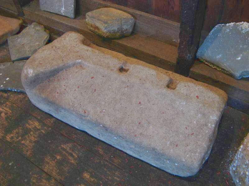
Part of a windowsill found at the site of the old village of Findhorn.
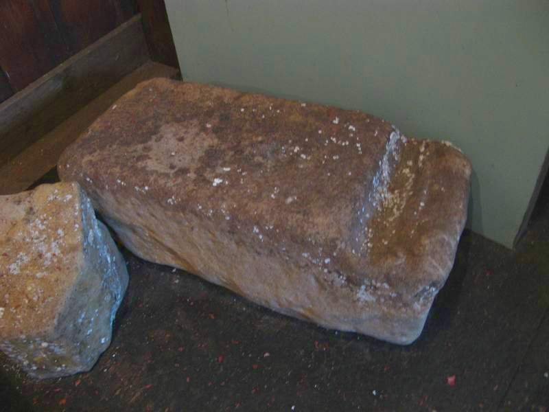
A skewputt
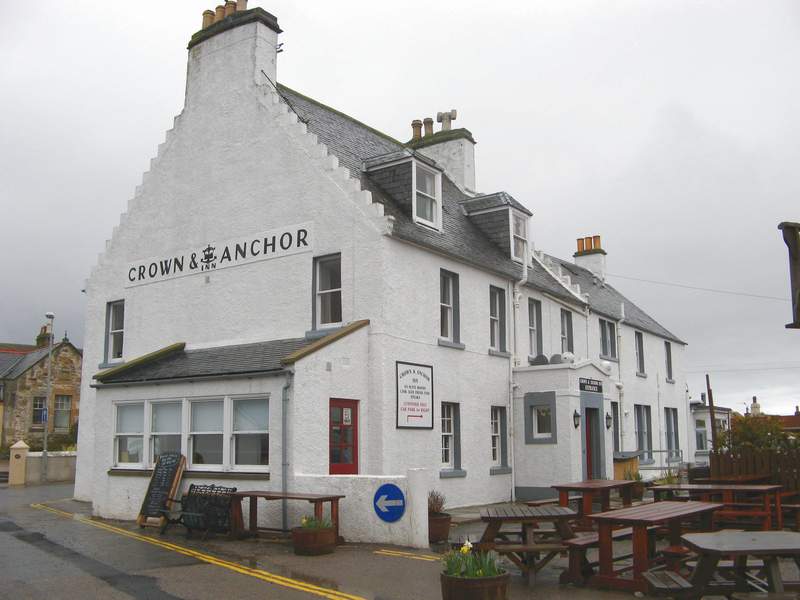
The Crown and Anchor, built in the new village of Findhorn in 1739.