Abandoned Communities ..... Norfolk
The village of Godwick came into existence earlier than Grenstein and it survived a little longer. The Domesday Book of 1086 tells us that at that date Godwick had 15 householders of various categories. During the fourteenth century Lay Subsidy returns and Poll Tax returns indicate that it had thirteen or fourteen taxpayers. The Lay Subsidy payment of 1334 was 24 shillings, an indication of the size and wealth of the village when you compare its rating with the average from six neighbouring settlements of 61 shillings 11 pence.
The history of Godwick is summarised in Leigh Driver’s book The Lost Villages of England, published by New Holland, 2006. More information can be gained from various leaflets and typescripts held at the Norfolk Historic Environment Record offices at Gressenhall. But a fuller description of Godwick and its history can be found in an article by Peter Wade-Martins and his colleagues in East Anglian Archaeology, 1982, Report no. 14, 59-67.
The village of Godwick ran for about half a kilometre along a single street. The street, part of the road that lay between Tittleshall and Whissonsett, had tofts along its northern side. The earthworks of the boundaries of seven of these tofts still exist. They can be seen more clearly in older aerial photographs. On the south side of the street lay the church and about four other tofts. A road branched off the main street leading south past the church, and parallel to it there was another road a short distance to the east. There would have been other tofts further to the east, but they have been obscured by post-medieval developments.
Near the eastern end of the village there was a large pond that supplied water to the mill at the north east corner of the pond. The main street would have run across the dam of the pond. The church, dedicated to All Saints, is thought to have been in existence before the Norman Conquest. The church tower that is prominent today is not part of the original church, though it is in the same position and may have been built from materials from the old church.
The desertion of Godwick took place gradually during the sixteenth century. A terrier (report of a land survey) of 1508 lists 18 messuages on the northern side of the main street, but states that nine of them were then void and two lately void. By the time of a terrier produced in 1588 two of the messuages occupied in 1508 had become void, but five others were said to be still in existence.
Other documentary evidence reveals that during that century holdings within the village were being acquired by the Lord of the Manor and one or two of the more wealthy tenants. In addition one of the inhabitants of Godwick, William Sheltram, in his will of 27 August 1506 bequeathed to the Prior and Convent at Westacre “all the places that I have bought in Godwicke”.
The history of Godwick is summarised in Leigh Driver’s book The Lost Villages of England, published by New Holland, 2006. More information can be gained from various leaflets and typescripts held at the Norfolk Historic Environment Record offices at Gressenhall. But a fuller description of Godwick and its history can be found in an article by Peter Wade-
The village of Godwick ran for about half a kilometre along a single street. The street, part of the road that lay between Tittleshall and Whissonsett, had tofts along its northern side. The earthworks of the boundaries of seven of these tofts still exist. They can be seen more clearly in older aerial photographs. On the south side of the street lay the church and about four other tofts. A road branched off the main street leading south past the church, and parallel to it there was another road a short distance to the east. There would have been other tofts further to the east, but they have been obscured by post-
Near the eastern end of the village there was a large pond that supplied water to the mill at the north east corner of the pond. The main street would have run across the dam of the pond. The church, dedicated to All Saints, is thought to have been in existence before the Norman Conquest. The church tower that is prominent today is not part of the original church, though it is in the same position and may have been built from materials from the old church.
The desertion of Godwick took place gradually during the sixteenth century. A terrier (report of a land survey) of 1508 lists 18 messuages on the northern side of the main street, but states that nine of them were then void and two lately void. By the time of a terrier produced in 1588 two of the messuages occupied in 1508 had become void, but five others were said to be still in existence.
Other documentary evidence reveals that during that century holdings within the village were being acquired by the Lord of the Manor and one or two of the more wealthy tenants. In addition one of the inhabitants of Godwick, William Sheltram, in his will of 27 August 1506 bequeathed to the Prior and Convent at Westacre “all the places that I have bought in Godwicke”.
Four
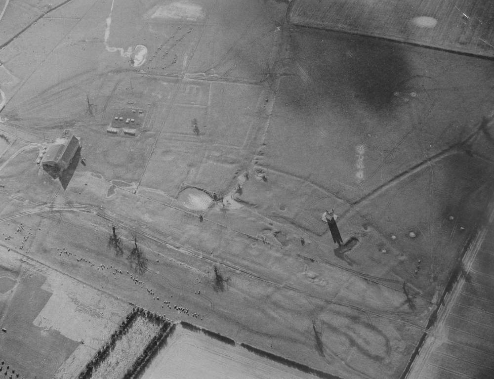
Godwick from the air, with south at the top of the picture
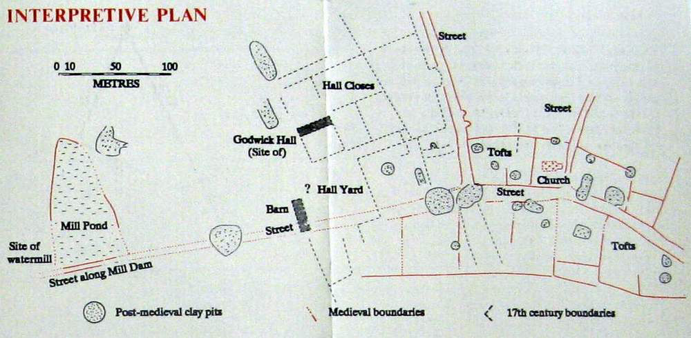
Plan of the village
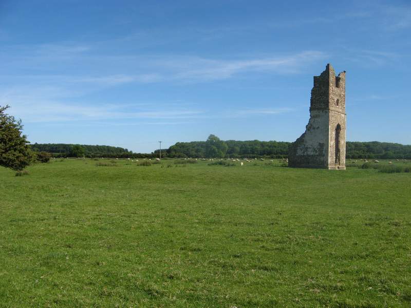
The church tower, with the main street running from right to left and another street leading off it in front of the tower.
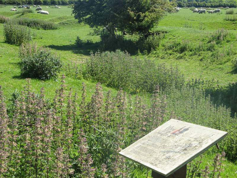
Other earthworks